
Starlink, Amazon Leo and the rest, live in 3D.
Watch the internet constellations move in real time: which satellites are over you tonight, when to look up, and how fast a packet crosses them.
- Starlink
- Amazon Leo
- OneWeb
- Qianfan
- Guowang
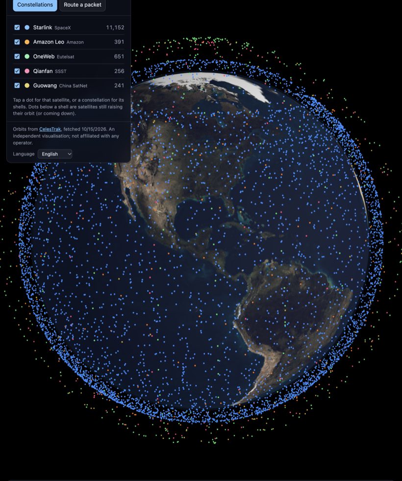 12,000+ satellites, live
See it for yourself.
Constela puts the low-Earth-orbit internet constellations on one 3D globe: Starlink, Amazon Leo, OneWeb, Qianfan and Guowang, every satellite in the right place, moving in real time, with day and night on the Earth below.
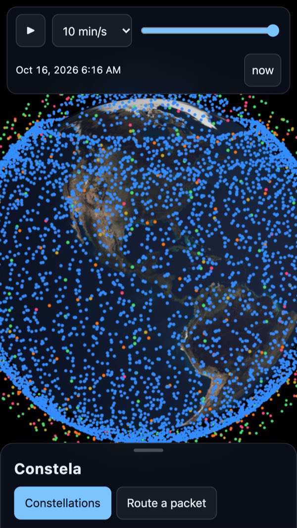
Every satellite, moving in real time 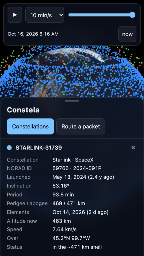
Tap a satellite for its card and orbit 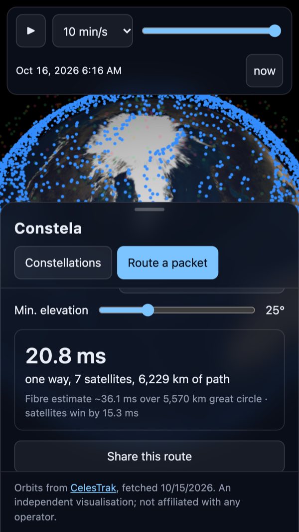
Route a packet and compare with fibre 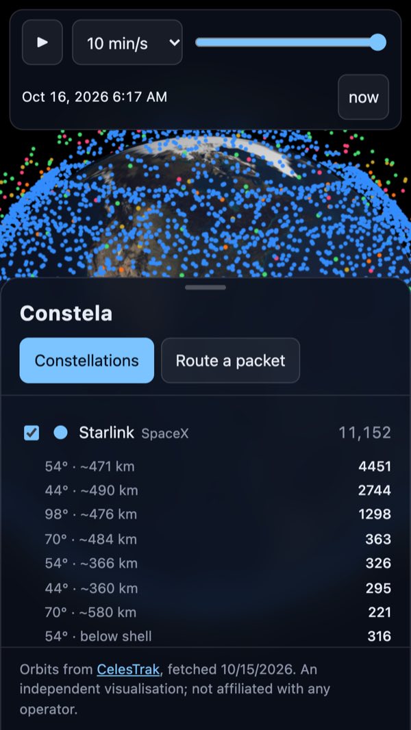
Each constellation, shell by shell
Your sky
- Use your location, pick a city or tap the globe: see how many satellites of each constellation are above you, the highest one, and the latency to it
- A sky chart of everything overhead, sunlit satellites bright and the ones in Earth's shadow faint
- Visible passes for the next two nights, with direction, height and brightness, and the “trains” of freshly launched satellites called out
- A reminder before a pass, so you are outside in time
- Look up through the camera: hold the phone to the sky and the satellites are drawn where they are
Explore the constellations
- More than 12,000 satellites, computed on your phone from public orbital data
- Each constellation broken into its shells by inclination and altitude, with the satellites still climbing counted apart
- Its whole history: launched, re-entered, and in orbit on any date since 2019, as a chart you can tap
- Coverage maps: how many satellites each place on Earth can see, and where there are gaps
- The next launches for every constellation, with countdowns and the pad on the globe
Tap any satellite
- Its name, catalogue number, launch date and orbit
- Live altitude, speed, whether it is in sunlight, and where it is in your sky
- Its full orbit drawn on the globe
Route a packet
- Pick two cities and a constellation and watch a packet go up, across laser links between satellites, and back down
- Or with no lasers at all, bouncing through ground relays, the way the first satellites worked
- The latency over the next ten minutes, every constellation side by side, and the comparison with fibre
A home-screen widget
- Satellites in orbit for each constellation, and the next launch
Real orbits. Honest limits.
Public data, standard maths, and models that say what they are.
Public data
Orbits and launch dates from CelesTrak’s public catalogue, launches from The Space Devs. Refreshed several times a day.
Computed on your device
SGP4, the standard orbit model, runs on your phone or in your browser: positions, passes, coverage and routes.
A generic routing model
Laser links to the nearest satellites in each shell, or ground relays with no lasers. Fibre runs at ⅔ of light speed over 1.3× the great circle.
Not how operators route
Nobody publishes how their network routes traffic. The latency is an estimate from published research, not a measurement.
The timeline’s blind spot
Re-entered satellites have no orbit left to draw: on past dates they are counted but not shown, and positions use today’s orbits.
Brightness is a rough guide
Pass brightness comes from a standard magnitude per constellation, adjusted for distance and phase: good enough to rank passes.
Constela is an independent visualisation built from CelesTrak's public catalogue, The Space Devs' launch schedule and generic models from published research. It is not affiliated with SpaceX, Amazon, Eutelsat or any other operator, and it does not model how any of them actually route traffic. No accounts, no ads, no tracking; your location never leaves your phone.
Questions
Is Constela free?
Yes. Constela is free on iPhone, Android and the web, with no ads and no account.
Which constellations does it show?
Starlink (SpaceX), Amazon Leo (Amazon), OneWeb (Eutelsat), Qianfan (SSST) and Guowang (China SatNet): more than 12,000 satellites in low Earth orbit.
Can I see the satellites with my own eyes?
Often, yes. “Your sky” lists the visible passes of the next two nights for your place. A satellite shows only when it is sunlit and your sky is dark, so passes cluster after dusk and before dawn.
Is it affiliated with SpaceX, Amazon or Eutelsat?
No. Constela is an independent visualisation built from public data. It is not affiliated with any operator and does not know how any of them actually route traffic.
Does it track me?
No. There are no accounts, analytics or ads. Your location is used only if you ask, rounded to about a kilometre and never sent; the camera view records nothing. Privacy
Does it work offline?
The iPhone and Android apps keep the latest orbits for offline use and fetch fresher ones when they can. The web version loads current data when you open it.
Look up.
Thousands of internet satellites are passing overhead right now. See where.